NSS-CDS
Little River Springs Map - New
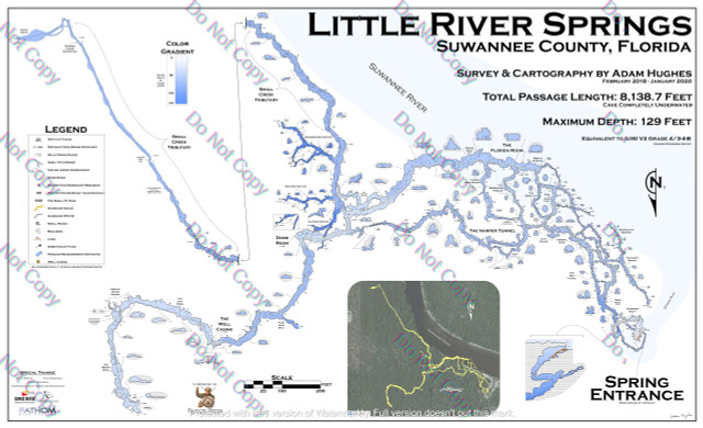
Little River Springs Map - Survey and Cartography by Adam Hughes
28" x 46" printed in full color on glossy styrene paper.


NSS-CDS Cartography is the companion course to Underwater Cave Surveying, focused on turning survey data into finished underwater cave maps. The official NSS-CDS page describes the course as introducing the basics of underwater cave map making and completing the survey process by producing an actual map. It includes a review of surveying technique, manual and computer-aided data reduction, data verification, error correction, materials and supplies, and transforming data into a finished map.
This course is open to anyone with an interest in underwater cave mapping, but NSS-CDS expects participants to have knowledge of cave diving and underwater surveying. It is a non-diving course, so there are no dive equipment requirements and no in-water certification outcome. A good participant is someone who understands why raw survey notes are only useful if they can be reduced, checked, presented clearly, and preserved for future cave-diving and conservation work.
Training generally takes the better part of a day. In High Springs, Florida, Cartography can help cave divers, project volunteers, and survey teams make better use of the data collected in local systems. The expected outcome is a stronger understanding of how to move from survey measurements to a readable, useful cave map, while respecting data quality, copyright, and the practical limits of the original survey.
NSS-CDS